What is Wi-Fi Locate, and how does it improve vehicle positioning?
If you've ever watched a bike or scooter glitch on a map three streets away from where it's actually parked, you know the problem. GNSS positioning (GPS, GLONASS, Galileo, and BeiDou, to name a few) is the backbone of vehicle tracking. It's also the first thing to fail exactly where small electric vehicles spend most of their time: dense city centers, underground parking, courtyards, covered racks, entryways.
For product teams building fleet software or theft-recovery tools, that's not an edge case, it's a daily issue. Here's why GNSS alone isn't enough, how Wi-Fi Locate fills the gap, and how Comodule combines both to deliver 2,5 meter accuracy in our latest IoT solution.
Why GNSS struggles where you need it most
GNSS times signals from satellites roughly 20 000 km overhead. Remarkably accurate in open sky, but dependent on a clean line of sight. Three things break that in cities:
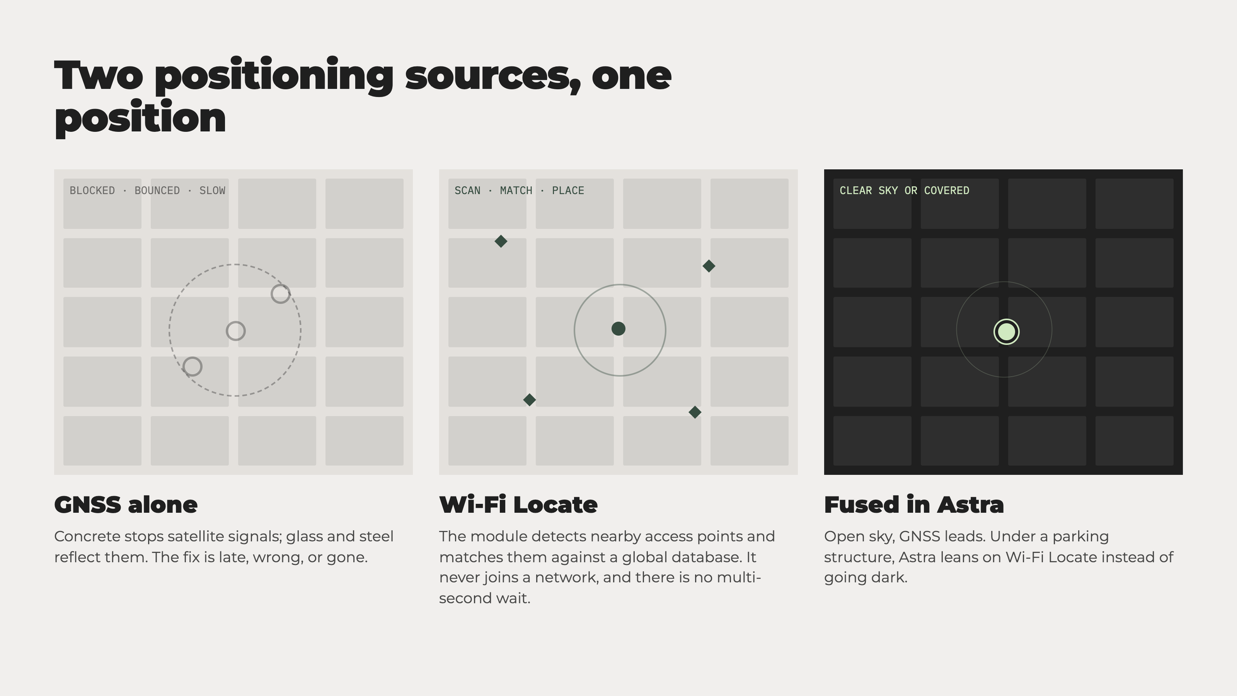
Signal blockage: concrete, steel, and underground structures stop satellite signals. No signal, no accuracy.
Signal bounce error: tall buildings reflect signals off glass and steel before they reach the receiver, so the device calculates position from a delayed signal. This urban canyon effect doesn't fail loudly, it just reports the wrong spot with high confidence.
Cold start delay: a GNSS receiver needs time to find its location after power-on or a long signal gap.
None of this is a hardware defect, it's pure physics. Every GNSS chip hits the same wall indoors and in dense areas. The fix isn't a better chip, it's an alternative positioning source.
What weak positioning costs you
Weak positioning shows up as small, expensive frictions across the operation. A technician sent to recharge a vehicle can end up at the wrong address, and cold start delay means it may take a moment for the position to become accurate even once reconnected.
Riders feel it too, someone who reserved a scooter three streets away blames the app, not the satellite. When a vehicle goes missing, weak positioning slows recovery right when it matters most, an approximate but available position beats a precise one that goes dark inside a parking structure. And every wrong pin on the map eventually becomes a support ticket.
The result isn't one dramatic failure, it's a steady drag on efficiency, support load, and rider trust.
Wi-Fi Locate uses the city as a positioning layer
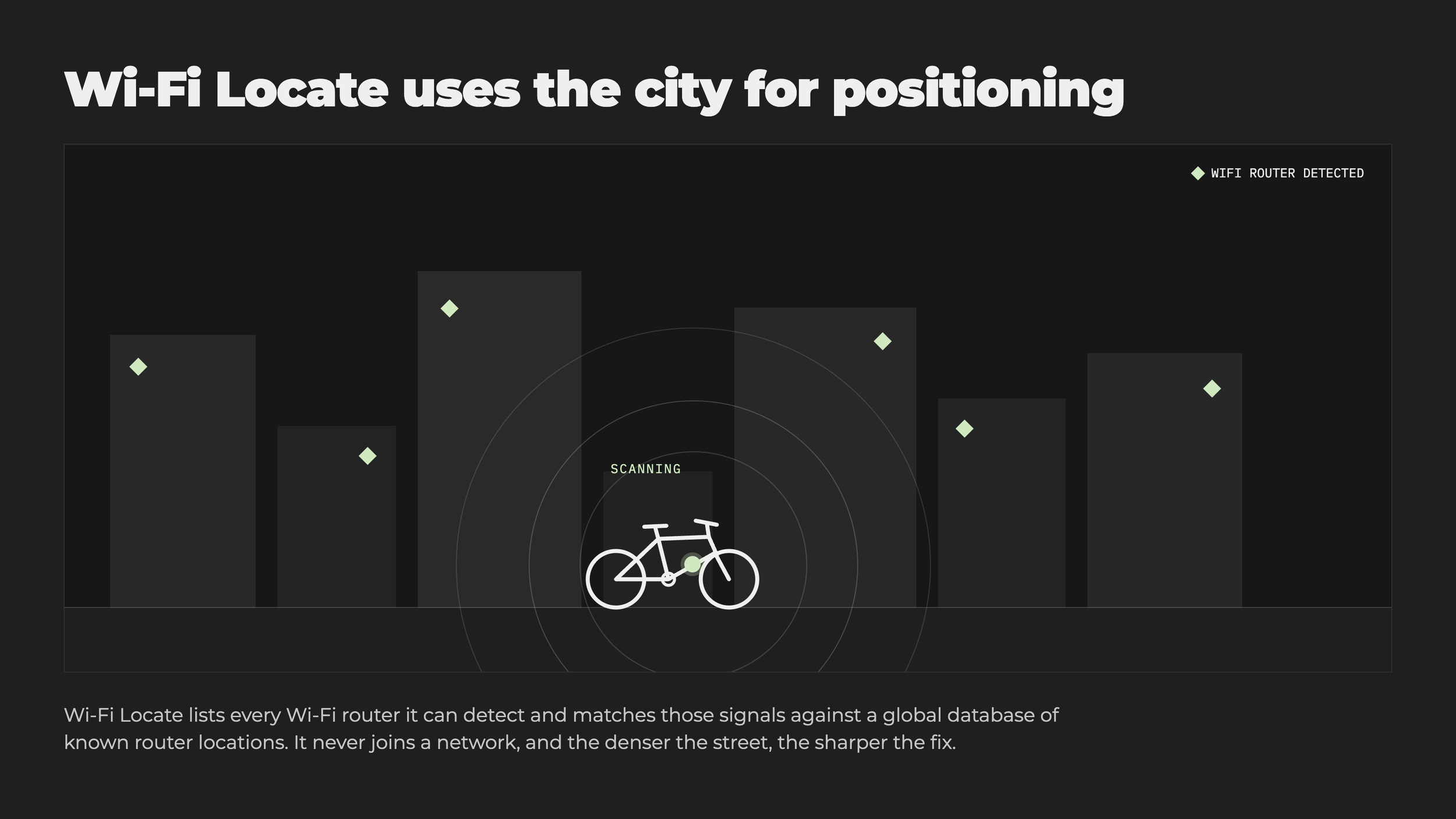
Instead of satellites, Wi-Fi Locate scans nearby Wi-Fi access points in cafes, apartment buildings, offices, and matches the signals against a global database of known access-point locations to calculate a position. No network connection to any of those networks is needed. More buildings and access points around a vehicle means more reference points for Wi-Fi Locate. And it's fast, with no multi-second delay, unlike GNSS.
Using both positioning options for best results
Comodule's Astra treats GNSS and Wi-Fi Locate as two inputs for one position. Clear sky, GNSS leads. Under a parking structure or between high-rises, Astra leans on Wi-Fi Locate instead of going dark. Wi-Fi Locate is a good fallback, not a replacement for GNSS. Its accuracy depends on local access-point availability, and it can't match GNSS's clear-sky precision. It also can't give altitude.
That use of both is what supports Astra's 2,5-meter accuracy claim: reliable across both indoor and outdoor, urban and open conditions, the environments small electric vehicles actually operate in.
What to consider when choosing vehicle positioning solutions
Indoor and urban tracking isn't a smaller version of GPS, it's a different problem that needs a different toolset. As mentioned, a combination of GNSS with Wi-Fi Locate stays useful everywhere micromobility vehicles actually ride. Fewer blank spots on the map, more accurate positioning, for riders and product teams alike.
A few suggestions for fleet operators and electric vehicle product managers
Design for signal confidence, not just coordinates. Treat a Wi-Fi Locate position in a dense area as a medium-confidence signal, not equal to a clean GNSS one.
Plan the indoor handoff. Outdoor-to-indoor transitions are where maps visibly jump or freeze. Design last-known-good states for it.
Give geofences breathing room near buildings, where open-sky assumptions break down, and Wi-Fi Locate is doing the work.
Theft recovery and dispatch benefit most, as an approximate indoor position beats a precise outdoor one that goes silent everywhere else.
Contact Comodule’s team to find a suitable solution for your brand sales@comodule.com